|
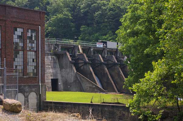
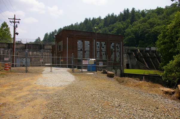
Nantahala Power and Light's Mission Dam
|
|
We discovered the Tapoco Project, and Thorpe and Nantahala Dams, when we
sere studying a TVA pamphlet that had a rough map. They were not
identified, just indicated on the map. Mission Dam was not indicated at
all (but then none of the other smaller NP&L dams were either), so it
was a surprise to us when we discovered it while we were researching the
NP&L quest. It is located between TVA's Chatuge and Hiwassee Dams, on
the Hiwassee River. Turns out it was the first!
|
|
|
The City of Andrews built the dam in 1924, to supply power to the
locals. NP&L bought the facility in 1929, and upgraded it in 1943. The
FERC licensed it (#2619) in 1980. Hiwassee was completed in 1940,
Chatuge in 1942, and Appalachia in 1943.
|
|
The dam was originally constructed as an Ambursen type dam, but in 1999,
due to "concrete deterioration" (probably AAR), a lot of the
chambers were filled in, making it essentially a gravity type structure now.
The dam has a total length of 397 feet and maximum height of 50 feet.
The controlled spillway has seven 16 foot wide by 14 foot high Tainter
gates. Three of the gates are automatically operated, the rest are
operated manually by a moveable hoist (no fuse plugs here!). The power
house was built with two turbines, a third was added during the upgrade
in 1943. Each drives a generator rated at 750 kVa, 0.8 power factor (600
KW), so call total capcity 1.8 Megawatts. Hydraulic capacity is given as
786 cfs.
|
|
|
The reservoir is 47 acres at full pool of 1658.17 feet MSL. The drainage
area is 292 square miles, "of which 189 square miles are impounded
the TVA Chatuge Dam." (Interesting!) Average inflow is 661 cfs.
Flood storage is negligible.
|
|
|
|
|
|
|